Above all, do not lose the desire to walk. Every day I walk myself into a state of well being and walk away from every illness. I have walked myself into my best thoughts and know of no thought so burdensome that one cannot walk away from it
Soren Kierkegard
Walking was in my blood. According to my mother, when I was born, the Malaysian midwife who delivered me told her that I had walker’s feet. The rest, as they say, is history!

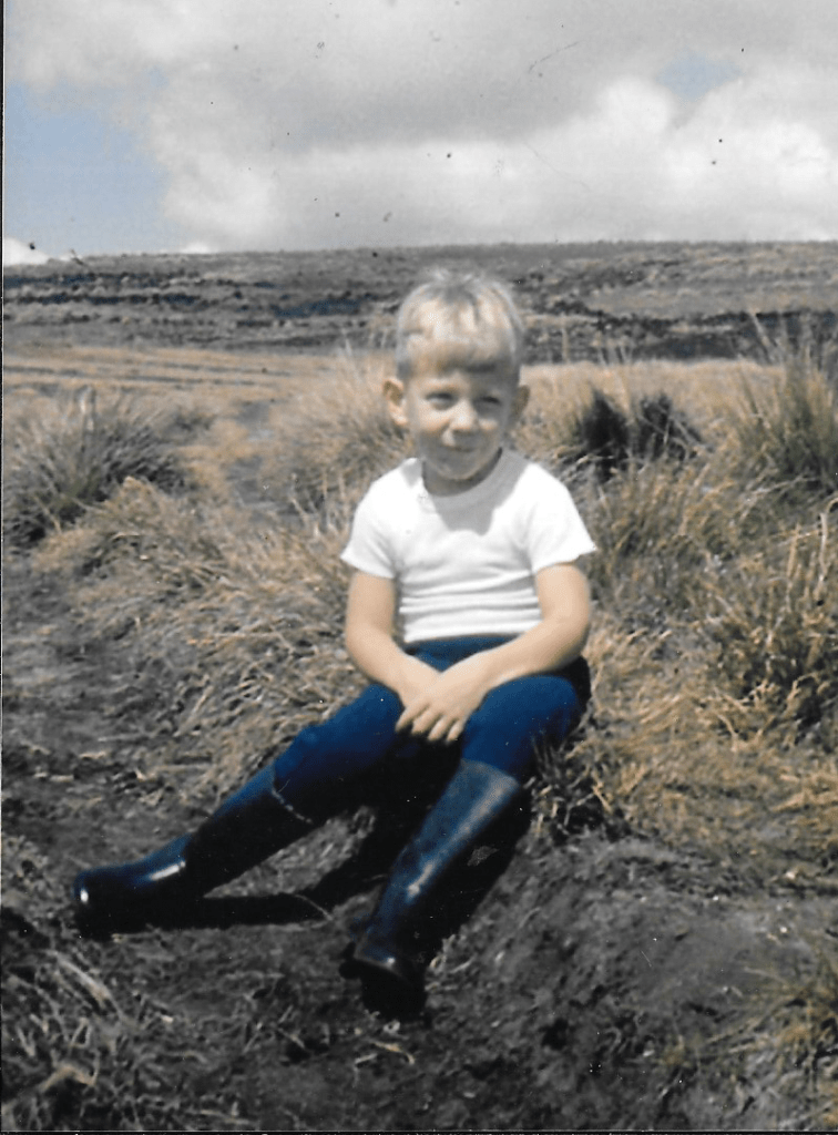
My earliest memory of walking was in Sri Lanka (or Ceylon as it was then) in the 1960s. I must have been 5 or 6 years old and I was walking with my father from Farr Inn to World’s End on Horton Plains. The round trip was around 10km. I remember questioning why my father had insisted on dragging me out of bed at the crack of dawn and then having to accompany him on a hike to the back of beyond. It was insufferably hot and I was thoroughly exhausted by the time we made it back to the Farr Inn. But at the same time I was curiously elated that I had somehow managed to complete the walk under my own steam. In a funny way that day on Horton Plains probably got me hooked on long distance walking!
So on the cusp of my 61st birthday, it’s fun to reminisce about twenty five of the most memorable walks I’ve undertaken over the last sixty or so years and contemplate what still lies ahead on my bucket list of long distance walks. (NB – this is a very long blog, so be warned!)
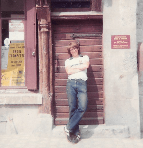
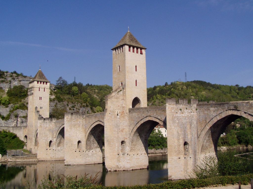
1. Offa’s Dyke Path (1980) – UK
In the summer of 1980, as a callow 16 year old, I embarked, with a school friend, on a foolhardy attempt to walk the length of Offa’s Dyke (186 miles). Kitted out at the local Millets store in Winchester with a fluorescent orange rucksack (that proved to be porous), a pair of heavy leather boots (which I hadn’t bothered to “break in” prior to setting off on the walk), and a Vango two man tent (which weighed a ton) we headed off from Chepstow towards Monmouth full of schoolboy optimism that we’d reach the end of Offa’s Dyke Path at Prestayn within a week. It would be a breeze.

Things went pear shaped pretty quickly. We soon realised the error of stuffing our rucksacks with enough provisions to feed a small army including tins of Fray Bentos steak and kidney pudding and Heinz Treacle pudding. Having pitched our tent in a field near Monmouth on our first evening, we discovered to our chagrin that we’d forgotten to pack a tin opener! Two days later as we trudged through incessant driving rain beyond Pandy into the Black Mountains ,soaked to the skin with badly blistered feet, I was beginning to wonder why I’d ever thought long distance walking would be enjoyable rather than an exercise in extreme masochism!


By the time we got to Hay-on-Wye, drenched and despondent, my friend had had enough and decided to hot foot it back home to Kent. Abandoning the tent, I decided to continue, opting for a range of hotel accommodation in Hay-on-Wye and Hereford as well as a couple of diversions to stay with a friend whose parents owned a castle near Ross-on-Wye and another who owned a large stately home and estate near Shrewsbury! In all I probably walked no more than a 100 miles but the blisters on my feet finally got the better of me. I was forced to reluctantly abandon the walk and return home with my tail firmly between my legs. It was an inauspicious introduction to the joys of long distance walking!
It wasn’t until 2010, some thirty years later, that I finally managed to complete Offa’s Dyke Path, covering the 177 miles between Chepstow and Prestatyn in 8 days. The motto of the story? if at first you don’t succeed, try, try and try again!
2. The Loire River Way (1981) – France

The Loire River Way (GR3) stretches for 1,300km and was the first long distance path to be opened in France. I set off from Azay Le Rideau to walk the trail with two school friends from WinColl in August 1980.
The trip got off to an inauspicious start. We embarked on an evening train from Waterloo, caught an overnight ferry to Calais where we connected to a train to Paris. We had consumed so many beers on the Channel crossing that we’d had virtually no sleep at all. With our train to the Loire Valley not due to depart until lunchtime, we attempted to grab some much needed sleep on some benches in the Tuileries gardens outside the Louvre. This proved to be a major strategic error as no sooner had we nodded off than we were rudely awaken from our slumber by a couple of angry looking gendarmes! Sleeping on benches was strictly interdit they brusquely informed us. Attempts to plead our case in basic O level French, proved in vain and we were summarily turfed out of the park like a trio of drunken hobos.
The journey deteriorated further after we had reached the start point of the walk – Azay Le Rideau, where there was supposed to be a chateau that was worth a visit. Somehow we missed it! Nor did we do any better with the chateaux of Chambord or Chenonceau, neither of which we reached. Instead, blighted by an extreme heatwave and blisters, we barely made it 15km to a campsite with a swimming pool where we decided to hole out for the remainder of our walk.
I think we may have struggled on and made it to Tours (38km from Azay-le-Rideau!) , but my recollection of the rest of the walk is fairly hazy apart from the insufferable heat and eating copious croques-monsieur in various cafes near the path. We did attempt to chat up some likely looking French girls at the campsite but our rudimentary French didn’t hit the mark and we were rudely rebuffed.
All these years later the chateaux of the Loire valley are still on my “to do” list. This time it might be easier to hop in a car and enjoy a bit of luxury rather than retracing my footsteps of over 40 years ago!
3.The Ridgeway (1986) – UK
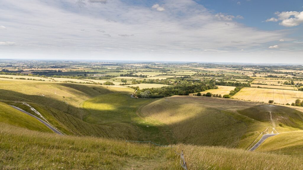
Having decided to take 9 months off after leaving university, I hatched a plan to walk the Ridgeway Path with a friend from university. The plan was simple. Meet up at Ivinghoe Beacon in the Chilterns and then walk 87 miles to Overton Hill near Avebury stone circle in Wiltshire. What could possibly go wrong?
The omens weren’t good. On the morning of the first day, news broke that the US space shuttle, Challenger, had exploded shortly after lift off, killing all 7 astronauts on board. It was a sobering start to our walk.

It turned out that walking a long distance footpath in January wasn’t a brilliant idea. The days were short with darkness falling shortly after 4pm. Just after we set off it started snowing. Snowflakes swiftly turned to heavy snow flurries and the walking became somewhat hazardous. The situation wasn’t helped by the fact that my friend was wearing a pair of suede loafers. It was clear that he had anticipated spending more time in the pub than actually walking!
Over the next 3 days, there was little let up in the weather. We struggled on through the snow and eventually made it to Goring, some 75km from Ivinghoe Beacon. By this time my friend’s feet were in a sorry state and he decided to throw in the towel and return home to Bedfordshire. It was the third long distance walk that I had failed to finish and the third walk where my companions had disappeared home early with blisters. Maybe it was time for me to start walking solo!
4. Jebel Sahro Trek (1986) – Morocco
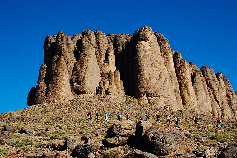
Trekking in the Jebel Sahro mountains of Morocco is like stepping into another world, where the stark beauty of the landscape captivates your senses and the silence of the mountains soothes your soul. Nestled between the High Atlas and the Sahara Desert, this lesser-known region of Morocco offers a unique blend of dramatic rock formations, remote Berber villages, and an experience that feels both timeless and unforgettable.
The reason I decided to go on a 2 week organised trek in the Jebel Sahro in February 1986 was simple. After an 8 month holiday after leaving Oxford the previous summer, it was the last opportunity to enjoy freedom before starting a 9-5 desk job at the Hong Kong and Shanghai Banking Corporation. It would be an opportunity to escape the grips of an English winter, enjoy the sights and sounds of Marrakech and stretch my legs in the North African sun.
My fellow walkers were an eclectic bunch. They included a corpulent middle aged German bird watcher who’d never done any long distance walking before, a petite 20 something lawyer from London who everybody on the trek fancied, and Nigel, who worked in the city and had a yearning to flee England and live in the Middle East. It was Nigel who I ended up sharing a tent with on the trek.
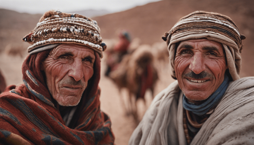
What do I remember of the trip? The Berber nomads who accompanied us, the wonderful pigeon tagine, the majestic arid landscape and the arduous ascent of Mount Toubkal. Apart from the odd rock pigeon and sparrow, I don’t remember seeing any birds worth mentioning. And as for Nigel – some months later I met up with him for a drink in the city. He’d bought himself a thick Arab djellabah in a souk in Marrakech which he had taken to wearing at the weekend around the supermarket in Chislehurst where he lived. I subsequently got a letter from him – he’d moved to Saudi Arabia and was loving his new life there. And as for me? A year later I was living in the lap of luxury on the peak in Hong Kong!
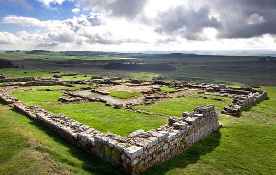
5. Hadrian’s Wall Path (1986) – UK
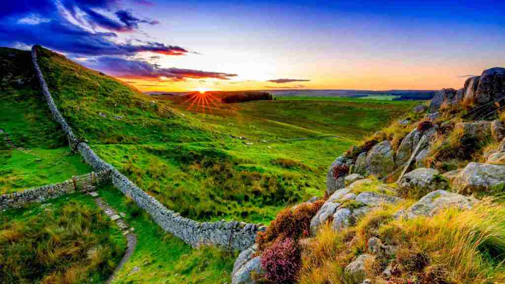
Hadrian’s Wall Path stretches 84 miles (135 km) coast to coast across northern England, from Bowness-on-Solway in Cumbria on the west coast to Wallsend, Newcastle upon Tyne on the east coast.
It passes through some of the most beautiful parts of England – from rolling fields and rugged borderlands to the vibrant cities of Newcastle and Carlisle – with dozens of fascinating museums along the way.
Emperor Hadrian ordered the wall be built to defend the wild northwest frontier of the Roman Empire against the Picts. Construction began in AD122, and it is thought to have taken only 10 years to complete.
The main defensive fortification was a 10-foot wall comprising 158 turrets, 80 guarded posts and 17 larger forts. The forts were built to station the local Roman legionaries who patrolled the border. The guarded posts (called milecastles with one built every Roman mile) allowed for the controlled movement of people across the wall. Between each milecastle, two turrets were positioned from where soldiers could spy any invading forces.
I walked the path over a sunny August Bank Holiday weekend in 1986 just before I headed off to live and work in Dubai. I started off from Bowness-on-Solway and headed east. Nowadays most guidebooks suggest walking the path in 6-9 days which gives you enough time to visit some of the Roman forts en route including Chesters, Housesteads and Vindolanda. I only had 3 days to complete the walk so didn’t have the luxury of visiting the forts – in fact I’d seen most of them already when I’d dragged my father around them all as a 16 year old on a fishing holiday in Northumberland!
The best stretches of the wall are in the middle section between Walton and Chollerford (54 miles) whereas the wall is hardly visible the nearer you get to the west and east coasts. I travelled light and stayed in youth hostels along the way. Averaging 25 miles a day I completed the walk in 3 days, hopped on a train in Newcastle and made it back to Manchester across the Pennines in time for work on Tuesday morning. It was the first long distance walk that I managed to complete and taught me a valuable lesson – travel light!
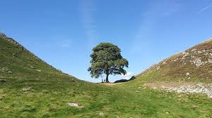
Nearly 40 years on, It’s strange and sad to think that the iconic sycamore tree, which for hundreds of years stood in a gap in the wall at Once Brewed, is no more – felled by a moronic vandal in September 2023.
6. Mae Hong Son Hill Tribes Trek (1987) – Thailand
En route from Dubai to work in Hong Kong for HSBC, I spent 3 weeks travelling around Thailand in September 1987. After a whistle stop tour of Bangkok, which included consuming the hottest ever red Thai curry while watching a Muay Thai boxing match, I made my way by train to Mae Hong Son near the Burmese border and signed up for a hill tribe trek.
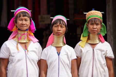
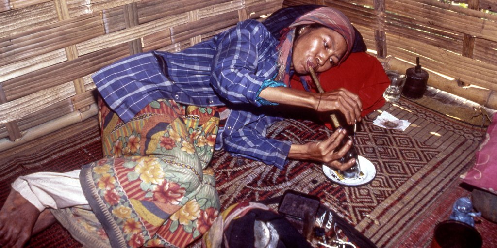
The walking wasn’t particularly arduous, but the tribes we visited and stayed with (the Lisu, Lahu and Padaung) were highly exotic not only because of their ornamentation (copper neck rings in the case of the Padaung) but also because of the narcotic substances that were consumed of an evening, chief amongst which was opium. The opportunity to get high on opium had been one of the selling points of the hill tribe trek so it seemed foolish not to give it a try. As the other members of the trekking group lay around the bamboo hut in various states of hallucinogenic tranquillity, I was lying on my side wondering why the opium I was smoking was having absolutely no effect on me despite the fact that I’d already smoked 10 pipes! I went on to smoke another 40 pipes. Sad to relate I can’t remember anything exciting happening to me at all apart from waking up the next morning with a splitting headache! So much for drugs. Once was enough. I never tried them again!
As the trek neared its end I hooked up with an American journalist on the trek and with a local guide, headed off into the jungle in an attempt to track down a leader of the Burmese Karen rebels who were fighting the military junta led by Ne Win. As we travelled down the River Moei, which marks the border between Thailand and Burma, the cackle of chimpanzees high in the jungle canopy was frequently interspersed with staccato machine gun fire! It did occur to me at the time, that my parents wouldn’t have been best pleased if they had had any inkling of what I was up to!
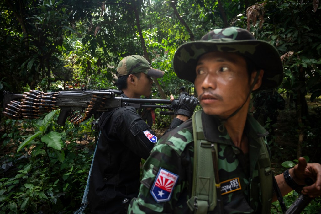
Eventually we came to a clearing in the jungle beside the river and were escorted into a small bamboo hut to meet ‘the rebel leader’. Well at least this what were told by our guide. As we didn’t speak a word of Burmese between the two of us, it was difficult to be entirely sure about the leader’s credentials. I had my suspicions that he wasn’t all that he was cracked up to be. He had a large paunch, didn’t look particularly imposing and although there was a guitar propped up against the wall, there was nothing to suggest that he was the leader of a well trained guerilla army! To this day, its the only walk that I have been on that has taken me to a combat zone and its the only walk where I’ve taken drugs!!
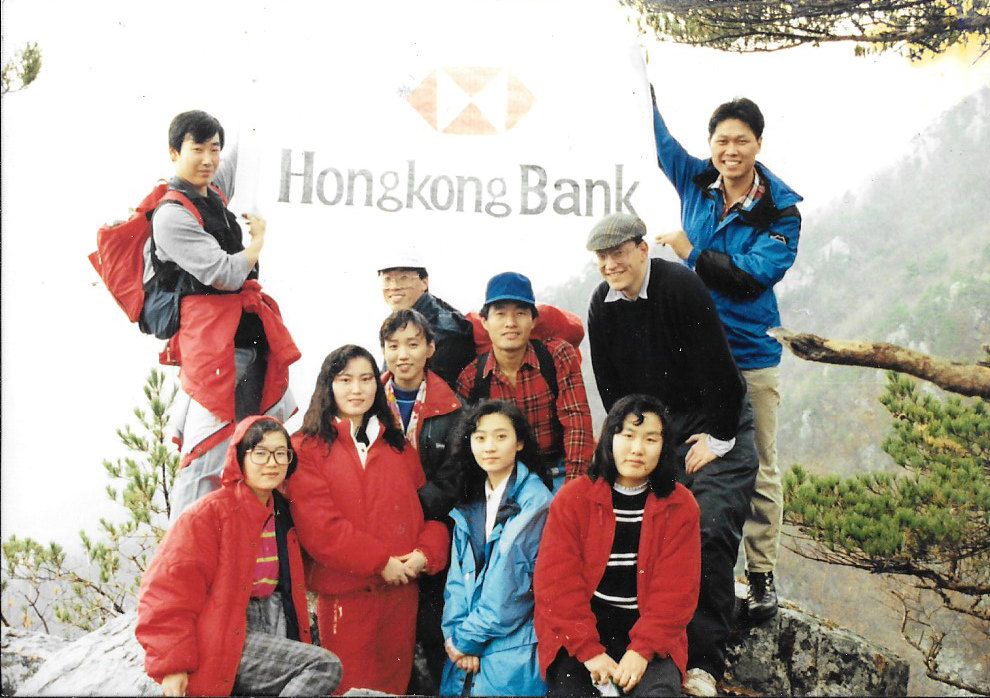
7. MacLehose Trail (1987) – Hong Kong

The MacLehose Trail is a 100-kilometre hiking trail that crosses much of the New Territories in Hong Kong, starting from Pak Tam Chung in the east to Tuen Mun in the west. It is the longest trail in Hong Kong and its the location for the ‘Trailwalker’, an annual fundraising event which comprises teams of four people walking the entire trail over the course of a weekend. The record, set in 2013, is a mind boggling 10 hours 58 minutes!
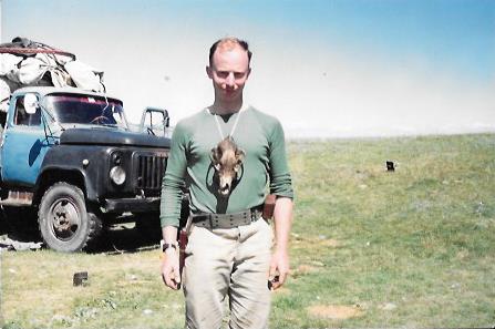
I never tried the Trailwaker challenge but over the course of the two years working in Hong Kong in the mid 1980s I walked all of the MacLehose Trail, either on my own or with Matthew, a university friend working for the Foreign Office in Hong Kong, with whom I subsequently travelled to Mongolia to fish for Taimen (giant carnivorous land locked salmon) in 1992.
The MacLehose Trail is an unforgiving 100km hike up and down some of Hong Kong’s highest peaks and through it’s most stunning landscapes. With its beautiful beaches and coastlines, urban views over Kowloon, ridges, peaks, forests, jungles, reservoirs, grassland, and monkeys, the MacLehose Trail gives the lie to the popular notion that Hong Kong is a crowded dirty metropolis with minimal green spaces for long distance walking. If you forgot about the 99% humidity and the 35C heat, at times you could be forgiven for thinking that you were on the west coast of Scotland!
My favourite part of the trail was the 7km stretch between the beaches of Long Ke Wan and Sai Wan. Many was the weekend spent camping on isolated beaches, eating crabs over a camp fire looking up at the constellations in the sky above, a million miles away from the hustle and bustle of downtown Hong Kong.
It could be a dangerous place. I remember wading through a reservoir on one occasion and spotting a mangrove water snake less than a couple of metres away. Although rarely lethal, a bite from one of these “critters” was well avoided. On another occasion I ran into a typhoon and spent what seemed like an eternity sheltering from the storm on a beach, praying that the fork lightning bolts which were randomly striking rocks in the vicinity weren’t going to be attracted to Matthew’s makeshift stingray harpoon (an improvised Cantonese barbeque fork) that was protruding from his backpack just beside me!
8. Jomsom Trek/Annapurna Sanctuary (1988) – Nepal
When I arrived in Pokhara for my Annapurna Sanctuary Trek in 1988 I was met by a team of four Nepali sherpas, several mules and the trek leader. By the look of things there were enough provisions to feed a small army which was great. There was just one problem – there was nobody else on the trek apart from myself!
I’d originally planned to join a mountaineering expedition to scale Mount Paldor, a 5,896m/19,344 ft peak in the Langtang/Ganesh Himal region of Nepal. However, for some reason all the other prospective members of the expedition, who were , like me, based in Hong Kong, had had to pull out. So I was forced at short notice to change my travel plans and opted for a 10 day trek to Annapurna Sanctuary..
Feeling more than slightly embarrassed that I was the only person on the trek, we headed off towards Annapurna Sanctuary. Each day began with a breakfast of gargantuan proportions. Everything had been laid on, including peanut butter in glass jars, the height of luxury. Eating in splendid isolation surrounded by towering Himalayan peaks, was in a sense a sublime experience but I couldn’t help feeling slightly embarrassed, wondering what the sherpas made of it all.
The day’s trekking began shortly after 10am. There was a two hour break for lunch (often in a tea house) and then a gentle afternoon’s stroll until around 3pm, when the day’s walking ended, camp was pitched and the evening meal was prepared. Although the mountain paths involved quite steep ascents and descents, it helped enormously that I wasn’t lumbered with a back pack and the fact that the mules and the sherpas were doing all the heavy lifting. But I was frustrated that our pace was dictated by the mules as well as the need to prepare three large meals a day!
We made good progress on the trek, so much so that we completed it in 5 days rather than 10! This begged the question, what next? I wasn’t keen on spending 4 days twiddling my thumbs in Pokhara watching the world go by. After talking with the head sherpa I came up with a plan. The trekking team and mules would be sent home (they had already been paid in full for the trek) and I would carry on with the trek leader to Jomsom, a 4-5 day trek. We would travel light and sleep in guesthouses rather than tents. It should have been a 10 day trek, but there was apparently an airfield at Jomsom where we could catch a plane back to Pokhara so we could do it in 5 days. What could possibly go wrong?
The trek to Jomsom was far more enjoyable than the one to Annapurna Sanctuary. The countryside was much more open and there were some spectacular panoramic views which included 8 of the world’s top 20 summits. The trek took us along the Kali Gandaki gorge, the deepest gorge on earth as well as Muktinath, (an important pilgrimage destination for Buddhists and Hindus), the hot springs at Tatopani and the Tibetan village of Kagbeni.
When we reached Jomson after three days trekking, there was some bad news. The only plane available to fly back to Pokhara had developed a problem and was grounded indefinitely! This posed something of a problem. My flight from Pokhara to Kathmandu left in 48 hours to connect the same day with my return flight to Hong Kong. The guide shrugged his shoulders and shook his head. There was nothing that could be done. But I had a different idea – why not try and walk back to Pokhara in a day rather than 3 days? We could leave at the crack of dawn and walk until sunset – a walk of some 40km across arduous terrain. My guide looked extremely doubtful, but reluctantly agreed to give it a go.
There were times the next day when I doubted we would complete the walk back to Pokhara by nightfall. But we made good progress, completing the first day’s walk by mid morning, the second day’s walk by mid afternoon and finally struggling into Pokhara shortly before dusk. I completed the final section of the walk in trainers after the sole of one of my walking boots dropped off! My guide was shattered and swore that he would never go on another trek with a mad Englishman! Meanwhile I was quietly happy that I’d completed not one but two treks (Annapurna Sanctuary + Jomsom) and effectively got a Nepali BOGOF deal – Buy one get one free!
9. The Hebridean Trail (1988) – UK
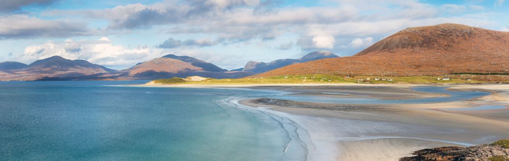
Inspired by Samuel Johnstone’s account of his journey across Scotland with Dr Johnson, after spending a week fishing with friends in Sutherland, I took a train from Forsinard to Ullapool and boarded a CalMac ferry to Lochboisdale on South Uist. My plan was simple – walk from South Uist to Skye via North Uist, Harris and Lewis. I reckoned that would entail walking around 150 miles across the Outer Hebrides.

After arriving in Lochboisdale on South Uist I spent a couple of days trout fishing in some of the hill lochs on the island before strapping on my boots and heading off on my walk across the Outer Hebrides. I spent the first night under canvas in a forestry plantation, plagued by midges and rutted furrows which ran underneath my tent. During the day, news broke that Ben Johnson had been busted for illegal doping after winning the 100m at the Seoul Olympics. It was a timely reminder that in 12 months time I would be heading off to live and work in South Korea!
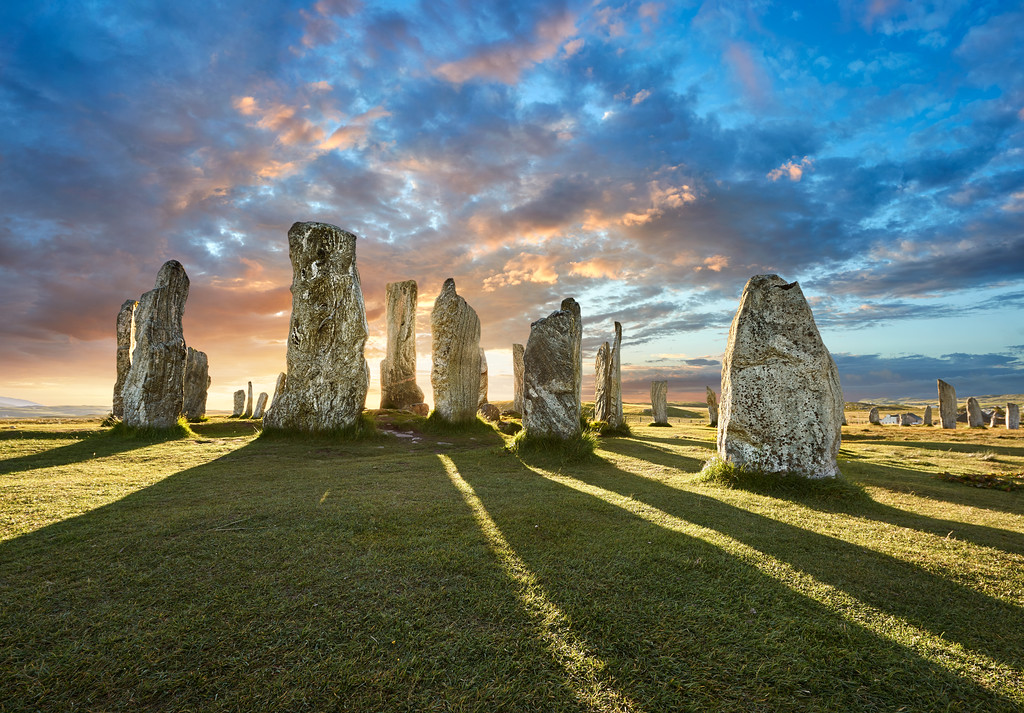
Amongst the highlights of the walk over the next fortnight was a visit to the Callanish Standing Stones on the Isle of Lewis. They may not be as extensive or as famous as the stone circles at Stonehenge or Avebury but in terms of tranquillity and spiritual transcendence, there is no comparison!.
Situated on a prominent local ridge, on a peninsula jutting into Loch Ròg, the location of the Callanish stones ensured that people could see the stones silhouetted against the sky from far and wide. The first stones were erected at roughly the same time as the inner circle of blue stones at Stonehenge. Over time the purpose of the stones changed.
Originally constructed in 2900BC, around 2450BC an avenue of stones were added. The stone circle forming the earliest part of the monument may have marked the position of the sun on and around midwinter, when it shone through a gap in the nearby hill Cnoc and Tursa, sending a ray due north, in line with the central standing stone.
Later on, when the avenue and rows were added, the monument was reorientated to focus on a remarkable lunar phenomenon. Every 18.6 years, when it reaches its ‘major standstill’ position in its long cycle, rising and setting to its furthest points, the setting full moon appears to skim along the horizon to the south – distinctively shaped, forming the silhouette of a lying-down woman, known locally as “Cailleach na Mointeach” or “The Old Woman of the Moors” – before disappearing and reappearing, lighting up the centre of the circle. People would have processed southwards along the avenue to celebrate this awe-inspiring occurrence.
Another highlight of the walk was visiting Rhenigidale, the most remote village in the UK. At the time of my visit it was the only settlement in the UK without a road link. Access was either by boat or by “the Postman’s Path”, a spectacular 6.5km coastal path that Kenny Mackay, the local postman used to traverse three times a week In the 1970s and 1980s.
The year after my visit they began building a road to Rhenigidale which was officially opened on 20 February 1990, after a decade of hard lobbying and fundraising. The first plans for a route were drawn up in 1974 but the campaigning actually went back to the 30s. It was not a fight easily won. I was lucky enough to visit the isolated settlement before the road was opened and can thereby boast that I have visited the only settlement in the UK that wasn’t connected by road!
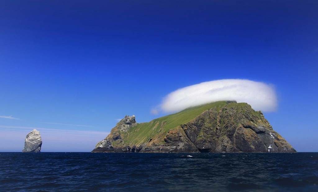
My only regret? That I didn’t make it to St Kilda, (a 2.5 hour trip by boat from the isle of Harris) which is a UNESCO heritage site and was home to a community of 200 islanders who lived there for thousands of years on a diet of seagulls and puffins before their population dwindled during the 20th century and the last 36 remaining islanders were removed to the Scottish mainland on the 29th August 1930.
10. Sentier de St Jacques (1989) – France

Quite why I should have set off to walk 470 miles/750km from Le Puy-en-Velay to Saint Jean-Pied-de-Port along the Sentier de St Jacques (GR65) in August 1989 after a year studying Korean at the School of African and Oriental Studies (SOAS) is a bit of a mystery. What is also a bit of a mystery is where I stayed en route all those years ago. Having retraced my steps this summer between Le Puy-en-Velay and Cahors, I can’t find any trace of some of the places I remember staying in! I’m pretty sure it wasn’t a figment of my over fertile imagination, but after so many years, who knows!
Crossing the granite plateau of the Aubrac was one of the highlights of the walk as was the night spent in a gite located in a medieval tower on a hillside that was used by locals as a refuge from marauding English brigands during The Hundred Years War. Although I stayed in a similar tower (called the Tower of the English), during my most recent walk on the GR65, I’m convinced that it isn’t the same place as I stayed in 35 years ago!

In the 1980s before the advent of the internet and portable phones, there was something infinitely liberating about striding out on a pilgrim path in deepest France without anybody in the world having much of a clue as to where you were and what you were doing. I shudder to think of my parents’ reactions if I had ever told them about half of the walks that I embarked on! Nowadays constant connectivity means that unless the battery in your GPS device or phone expires, you can be tracked anywhere on the planet by your nearest and dearest! How times change.
Two weeks into my walk I tried and failed to count up to ten in Korean. After a year studying Korean this came as something of a shock and was unlikely to be well received by the great and the good of HSBC when I arrived in South Korea to start my new job. Without further ado, I decided to abort my walk, hot foot it to Cahors and catch the earliest flight to South Korea. The completion of the walk to Saint Jean Pied de Port would have to wait until another day!
11. Jirisan Ridge Trek(1989) – South Korea
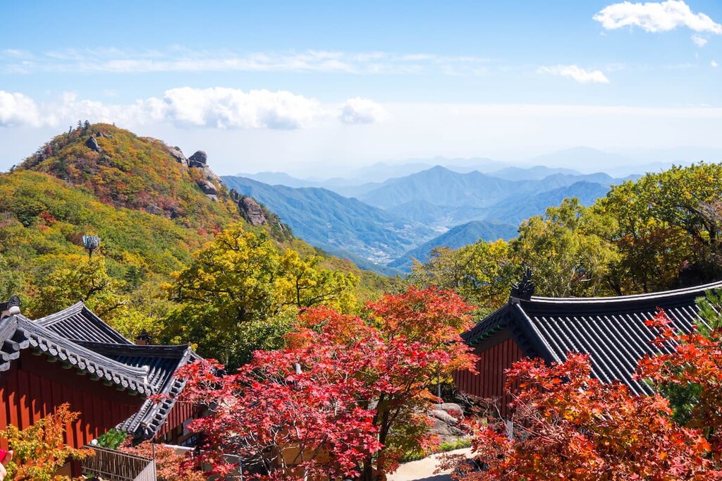
Over my 15 years living and working in South Korea I climbed an awful lot of mountains. Korea, is home to 7,846 named mountains, the highest and most prominent of which is Hallasan (한라산) at 1,950 m (6,398 ft) in elevation. At weekends, I would often hop on a train or bus and go off mountain hiking in one of South Korea’s many national parks.
The Jirisan Ridge trek sticks in my mind for one reason – it was the first mountain I climbed in Korea and the 40km trek along the ridge to the summit was one of the the longest mountain treks in South Korea.
At the beginning of October 1989 I found myself at the summit of Jiri-san with three Korean students who had also made it to the top. I was the first foreigner that they had met. The fact that I was at the summit of Jirisan, Korea’s 2nd highest mountain (1,915 m (6,283 ft)) was about as surprising as the fact that I could communicate with them in Korean.
I shouldn’t really have been climbing mountains in South Korea. I was due to report for work at HSBC in Seoul after a year of studying Korean at SOAS (the School of Oriental and African Studies) in London. The idea was that I would arrive for work in Seoul at the end of October, ready to “hit the ground running” with a fairly high level of fluency in “business Korean”. There were two problems with this plan. Firstly, SOAS didn’t teach “business Korean”. My tutor was a charming South Korean professor called Dr Pak Young-sook, whose main area of expertise was medieval Han dynast celadon pottery! The second problem was that after a month walking through the south of France on the Chemin de St Jacques I found that I couldn’t even count up to ten in Korean. In an attempt to spare my blushes and get my Korean up to speed, I had hot footed it to Seoul and spent a month travelling around the country, staying in Buddhist temples and using every opportunity I could to practise my Korean.
As to why I chose to climb Jirisan the answer was simple – as well as being one of three sacred mountains of Korea along with Geumgangsan and Hallasan, there is a Korean saying that when a stupid person stays in Jirisan, he becomes a wise person. The great irony about my panic stricken attempt to improve my Korean before turning up for work in Seoul, was that the job I was given (providing loans to foreign companies based in Korea) required absolutely zero knowledge of Korean! Ah well, at least it gave me an excuse to hike up Jirisan!
12. Abel Tasman Trail/Wangapeka Track (1992) – New Zealand
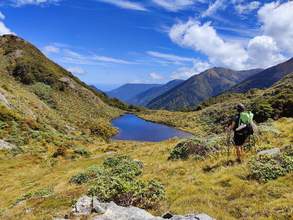
New Zealand boasts some of the world’s best long distance walks including the Milford and Routeburn hikes. To be honest though, the walks (called tramps in New Zeland) are hardly long distance. Most are between 25-60km and can be completed in 2-4 days so hardly on a par with the Camino!
I ended up doing 3 walks while I was in New Zealand. The first involved an ascent of Arthur’s Pass carrying a backpack which must have weighed 20kg and having my tent attacked by a kea, a feral pigeon native to New Zealand! One of the reasons my backpack weighed so much was that I’d brought my fly fishing gear with me as I planned to fish for my supper rather than carrying pre prepared meals. It didn’t prove a clever move – the New Zeland trout proved difficult to catch in the gin clear rivers and as a result, after 2 weeks walking, I ended up losing 15kg in weight!
The highlights of the walk included the 59km Wangapeka trail across New Zealand’s south island. Over the four day walk I didn’t see another person. I had a narrow escape on a particularly treacherous part of the walk which involved me falling off the side of a mountain into a river Thankfully my rucksack acted as a buoyancy aid and I managed to float across to the other side relatively unscathed. The Abel Tasman Trail proved a much more sociable route and most evenings I ended up camping out on beaches in the company of other walkers , gazing up at the Southern Cross and thinking that beautiful though New Zealand undoubtedly was, it was an incredibly long way from what I would call ‘civilisation’! Great if you like rugby and sheep but just a bit too remote for my liking!
13. Aconcagua (1995) – Argentina
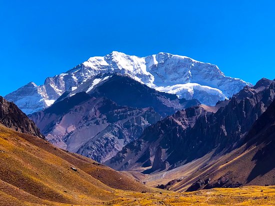
The trek to the summit of the highest mountaIn in the Americas (Aconcagua in Argentina – 22,632ft/5,961m) didn’t get off to the best of starts. As we began the 8km walk up the valley from Horcones to Confluencia we were greeted by the sight of a couple of mules descending the path in the opposite direction with a couple of coconut sacks slung over the saddle. These, it transpired, contained the bodies of two Japanese climbers who had fallen to their deaths in adverse weather on the final ascent to to the summit. It certainly added a certain frisson to the walk that lay ahead of us!
My decision to jump on a plane from South Korea, travel over 24 hours to Mendoza in the Argentinian wine country and join an expedition attempting to reach the summit of Aconcagua, was on the surface a strange one. I had zero mountaineering experience. and apart from running a marathon in South Korea in September 2005, I had done absolutely no training for the walk. My choice was probably the combination of several factors: a hare brained notion that I was a frustrated mountaineer and had the ability to eventually climb Everest! A long held ambition to visit Latin America, travel down the Amazon and visit the Inca sites in the Peruvian Andes. The desire to join an organised expedition rather than heading off into the wilderness under my own steam.
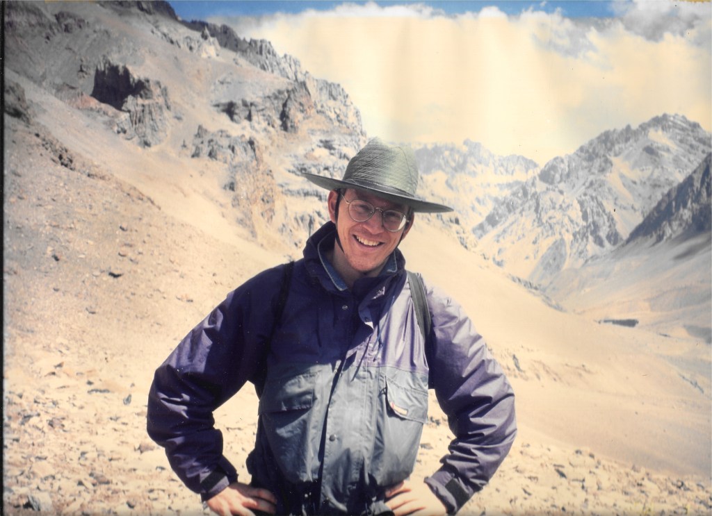
At the base camp at the Plaza del Mulos (Place of the Mules!) I had the first inkling that I probably wasn’t going to make it to the summit. I began to feel slightly groggy. 48 hours later, at the second base camp at 4,500m, I was feeling considerably worse. The chap I was sharing a tent with (a 65 year old retired English merchant banker called Auberon who lived in the south of France) was feeling equally rough. Our guide diagnosed both of us with HAPE (Higher Altitude Pulmonary Edema) and recommended that we leave the expedition and descend the mountain as fast as possible if we wanted to avoid suffering a similar fate to the two Japanese climbers in body bags that we had encountered on our way up. It seemed sensible advice which we followed to a T.

So my one and only mountaineering expedition ended in ignominious failure! Every cloud has a silver lining though. Back at our hotel in Mendoza, myself and Auberon wondered what to do with ourselves for the following week while the expedition was on its way to the summit of Aconcagua. So we decided to jump on a train to Santiago in Chile, travel by bus to the Torres del Paine National Park, then take a bus across the Andes via Bariloche ( the town where numerous Nazis, including the ‘Angel of Auschwitz’, Adolf Eichmann, fled after WWII) and return to Mendoza. It proved an inspired decision and I have absolutely zero regrets about not making it to the summit of Aconcagua!
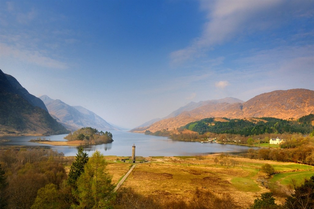
14. West Highland Way (1997) – UK
The 96 mile/154km West Highland Way regularly features amongst the world’s best long distance walks and it’s not hard to see why. Stretching from Milngavie on the outskirts of Glasgow to Fort William in the Highlands, highlights of the walk included walking beside Loch Lomond, crossing Rannoch Moor and Glencoe, and seeing Buchaille Etive Mor as well as Ben Nevis. I reached Fort William within a week and with time on my hands, decided to take a train to Glenfinnan to see the monument at the head of the loch commemorating the gathering of the clans in 1745.
On 19 August 1745, Prince Charles Edward Stuart rowed up Loch Shiel towards the tiny hamlet of Glenfinnan with a small band of his most loyal supporters. He had called on clan chiefs to muster their men and join him here for a daring quest to restore the Stuarts to the British throne.
When he arrived at Glenfinnan, there was barely a soul to be seen. But in late afternoon, the song of the pipes coming over the hill signalled the arrival of the first of 1,200 clansmen who pledged their allegiance to Bonnie Prince Charlie that day, before setting off to start their campaign.
While the ’45 ended in defeat at Culloden in 1746 and the Highlands suffered punishment and reprisals for years to come, the gathering of clans and raising of the royal standard (or flag) at Glenfinnan that summer was a moment of hope and enthusiasm for many.
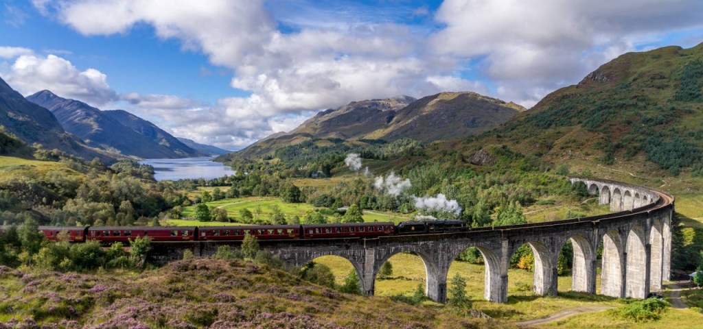
Nowadays, Glenfinnan is besieged with tourists eager to get a glimpse of the Glenfinnan Viaduct which features in many of the Harry Potter films. 1997 was the year that JK Rowling’s first Harry Potter book (The Philosopher’s Stone) was published, but in August 1997, the Glenfinnan Monument was blissfully free of hordes of camera wielding tourists from around the world.
Having walked around the impressive monument at the head of the loch I was keen to find somewhere for lunch as my train back to Fort William wasn’t due to leave for another three hours. Unfortunately, there wasn’t a refreshments kiosk, cafe or restaurant to be seen. There was, however, an impressive looking hotel, called the Glenfinnan House Hotel, which stood in magnificent grounds on the right bank of the loch. On a whim, I decided to wander up the long drive and see if I could get a bite to eat.
I rang the front door bell and an elderly gentleman with a moustache and a tweed jacket appeared. I enquired if I could get something for lunch. His wife was out shopping but he agreed to rustle me up a sandwich and invited me into the bar area. As he disappeared into the kitchen to prepare my sandwich, my eyes were drawn to the walls furnished with a variety of pictures depicting sporting scenes in the Highlands as well as an armorial crest of the Macfarlane clan of which I was a member!

When he returned with my sandwich I enquired about the significance of the Macfarlane clan crest. “I am a Macfarlane” came the response. ” What a coincidence”, I replied,”so am I. I am part of the Macfarlane sept of Brae Gartartan”. “So am I” he replied!”. It turned out he was a distant cousin. He owned and ran the hotel, played the pipes to the guests every evening from the minstrel’s gallery and took hotel guests out fishing on Loch Shiel. It was a strange but uplifting ending to a fantastic walk.
15 Sangre de Cristo mountains (2001) – USA

It was simple. Mike, an ex military American friend who had flown attack helicopters into North Korea, worked as a freelance photographer across Asia and joined me Taimen (carnivorous land locked salmon) fishing in Mongolia in 1996, had retired to live in Colorado where he had qualified as an attorney, invited me to stay and join him on a trout fishing expedition in the Rocky mountains. I jumped at the opportunity.
Mike suggested we head off to the Sangre de Cristo mountains on the Colorado/New Mexico border some 170 miles south of his home in Colorado Springs. The highest peaks rise to 14,350ft/4,375m but we would be trout fishing in the mountain lakes lower down. Nevertheless getting there would involve a 3 hour drive followed by a five hour hike into the mountains where we would camp for a week and hopefully live off the grilled trout we had caught. After a couple of days fishing the Colorado river near Mike’s house, we hit the road for the Sangre de Cristo range.
Besides the enormous distances between settlements and the ubiquitous four by fours I saw on the roads, two things struck me about this part of the US. Firstly the gargantuan meal portions served at restaurants and diners. En route to the Sangre de Cristo mountains we stopped at a “diner” where I had the temerity to order a ‘breakfast burrito’. This was a calorie bomb comprising an enormous burrito covered in lashings of cheese and accompanied by refried beans smothered in a glutinous sauce. Granted I was already carrying a few extra pounds around my midriff but this ample meal added inches to my already ample girth!
The second thing that struck me was the casual attitude to armed weaponry. Although we were only armed with fishing rods and trout flies, before we set off I had had a chance to look around Mike’s garage. The walls were covered with guns of all shapes and sizes that would have been sufficient to repel a small army. It seemed wise not to air my thoughts on the links between gun availability in the US and the country’s astronomically high homicide rate!
Blessed with fine weather our five hour trek into the mountains took us up to the snowline where we pitched camp beside a promising looking lake. Over the next 5 days, I was completely out fished by Mike who was benefitting from years of experience of trout fishing in the Rockies. What could be more enjoyable than fishing by day and sitting beside a camp fire eating grilled trout looking up at the starlit sky and enjoying the peace and tranquillity of being in the middle of nowhere? If I had shut my eyes, I could have imagined that we were almost back together Taimen fishing in Mongolia!
16. Laugavegur Trail (2001) – Iceland
The Laugavegur Trail in Iceland regularly ranks as one of the world’s top treks and its not hard to see why. Despite the fact that it is only 34 miles/55km long,the Laugavegur Trail offers a multi-day trek through the Icelandic wilderness. En route it passes through multi-colored mountains, lava fields, black sand deserts, geothermal springs, glaciers, lakes, icy river fords, grassy plains, and forests. The Laugavegur Trail has it all!
Having spent almost 3 weeks driving the length and breadth of Iceland in the company of two Belgian friends, Philippe and Claude, we decided that our Iceland trip wouldn’t be complete without embarking on the iconic Laugavegur Trail. We had visited the Gullfoss waterfalls, bathed in the geothermal hot springs of the Blue Lagoon in Reykjavik, gone on a whale watching expedition, seen the northern lights and caught an arctic char in a lake at midnight with the sun still shining. About the only things left on our “to do” list were puffin burgers and the Laugavegur Trail.

There was one slight problem with embarking on the trek together. Claude divulged that he had a chronic back problem and could only accompany us if we agreed to carry the contents of his backpack for him. As he grimaced feebly, we reluctantly agreed to play the ‘Good Samaritan’ and share his load between us.
There is no doubt that Iceland is a strange place. Quite apart from the fact that its incredibly difficult to buy alcohol outside a few licensed liquor stores, the geology of the island is unique. Iceland is an extraordinarily young piece of land. The oldest rocks are about 20 million years old (compared to a billions of years old in the UK). Around 20,000 years ago, the island was almost completely covered in an ice cap up toa kilometre thick, scraping the surface clear. People only arrived in 871 AD. The reason Iceland is so young is due to its unique formation. Iceland is part of the Mid-Atlantic Ridge, a line of underwater mountains stretching north to south from the Arctic to the Antarctic in the middle of the Atlantic Ocean. This where the continents holding Europe and North America, Africa and South America, are pulling away from each other, a process which ultimately began in the Jurassic, over 150 million years ago.
Lava erupts from the ridge, adding new crust to the ocean floor. Most of the ridge is kilometres underwater, but in Iceland it reaches the surface. Some think this is because Iceland gets a boost from something called a mantle plume, or a hot spot These are plumes of heat rising directly from deep inside the Earth. When the heat reaches the crust, it melts it and feeds volcanoes. On Iceland the ridge splits in two, and one branch, the Eastern Volcanic Zone, is the one that powers all the volcanic activity around the Laugavegur.
Our walk started in Landmannalaugar, a flat and grassy area amongst pale hills. The walk went straight up into the hills and soon we were walking over snow patches and also steaming fumaroles and boiling springs, many surrounded by colourful mineral deposits and brilliant green moss. This is the largest geothermal field in Iceland, which gets two-thirds of its energy, mostly for heating, from underground.

The pale rock that forms these hills is called rhyolite, which erupts as a sticky lava from volcanoes. This rock is unusual in Iceland, where the vast majority of the island is made from a darker volcanic rock called basalt (Iceland, compared to pretty much anywhere else on Earth, has an astonishingly small number of rock types). The hills we were walking over are in fact one big volcano, called Torfajökull, part of the Fjallabak Nature Reserve which was set up largely to protect the site. A jökull in Icelandic is a glacier, and it is common to see volcanoes referred to by the glaciers that cap them. The oldest rocks in Torfajökull are from about 800,000 years ago, and although you can’t see it from the ground because it’s so big, it does form a kind of crater, called a caldera. This formed when the volcano’s magma chamber, which made all the lava, emptied and sank. It last erupted in the 1470s which was recorded by Icelanders.
Having crossed Torfajökull we spent our first night in a crowded dormitory in the Hrafntinnusker hut. The next day the landscape changed from rhyolite hills to basalt ridges, which run north-east to south-west across the island and reflect the fact that Iceland is gradually being pulled apart. The whole area we were walking in is thought to be a relatively new opening of the Mid-Atlantic Ridge from about 3 million years ago.
Carrying the contents of Claude’s backpack wasn’t an enormous burden on the first two days but on the third and final day of our trek it became considerably more onerous. The cloud cover of the previous two days had evaporated and the cloudless skies were accompanied by a ten degree rise in temperature. Mid afternoon as Philippe and I struggled across a rocky volcanic plateau towards our destination for the night (a hut called Emstrur) we were bemused to see the figure of Claude suddenly lengthening his stride and motoring off over the horizon ahead of us! Some three hours later, bedraggled and exhausted, we finally reached our destination for the night. Claude was there to greet us, beer in hand and an embarrassed grin spread across his face. He had arrived some two hours earlier and had spent much of the afternoon leisurely loafing around wondering why his change of clothes was taking so long to arrive, along with his two walking companions! It was with some difficulty that I was able to restrain myself from throttling him!
17. Camino de Santiago (2004) – Spain
The Camino de Santiago probably needs no introduction from me to many of those reading this blog. Most of you will have heard about it and some of you will have walked it.
Everybody has their own stories about the 500 mile/800km walk along the Camino Frances from St Jean Pied de Port to Santiago-de-Compostella – romantic encounters, moments of spiritual enlightenment, nights spent in dormitory bunkbeds accompanied by the snoring of fellow pilgrims and the joy of finally reaching Santiago and seeing the giant botafumeiro swinging majestically in the cathedral aisle as pilgrims receive mass after their arduous journey to the shrine of St James.
In 2004 I decided to embark on waling the Camino. What better way to unwind from the stresses and strains of a high pressured job in the City than walking 420 miles/675km from Pamplona to Santiago de Compostela during the height of the Spanish summer in temperatures that sometimes exceeded 30C!. It was my idea of heaven. It would be some people’s idea of hell!
One thing I was struck by during the walk, was the sheer volume of pilgrims. At times it was like joining a never ending ragtag army of troops retreating from an enemy invasion. What a contrast with my walk on the pilgrim route in France some 15 years earlier when I had hardly met another soul during my fortnight’s walk from Le Puy-en-Velay to Cahors. What had changed over the previous 15 years? The appearance of computers, portable phones and the internet with the evangelical impact of social media promoting the benefits of embarking on the Camino.
There were some highlights on the walk, notably Burgos, Leon and Santiago. After a long day’s walk, nothing quite beats sitting out in a sunlit square enjoying a pilgrim meal washed down with a bottle of Spanish rioja. But in between times there was an awful lot of time spend pounding the tarmac, walking through busy conurbations and struggling to communicate with just a few words of Spanish.
Perhaps if I had been more adventurous I would have enjoyed the walk more. Instead I eschewed pilgrim hostels in favour of more upmarket albergues and kept myself to myself. How my approach to long distance walking has changed over the last 20 years. Nowadays I make a beeline for communal dormitories and take every opportunity to strike up conversation with complete strangers.

The most memorable part of the walk were the pulperias – the restaurants selling octopus, a Galician specialty. Over the years I’ve eaten quite a lot of exotic foods ranging from snake and dog (in South Korea) and griiled eel (South Korea and Belgium) to sheep’s eyeballs (the UAE) and puffa fish (Hong Kong). But perhaps the most enjoyable was live octopus (known as San Nakkji/산낙지) which I used to eat for lunch in the market behind our offices in Seoul when I first began working for SG Warburg in South Korean.
The dish (if we can call it that) can be served two different ways. One is to take a small species of octopus out of a tank, chop it up into tiny pieces, and serve it with sesame oil and other optional garnishes. When the dish is served, diners will find the remnants of the octopus still wriggling around the plate. Its a good idea to chew the octopus quickly and vigorously .

The other way to eat san nakji is to take the octopus straight out of its tank, wrap it around a wooden chopstick, dip it in sesame oil – and eat it in one bite. This method is only for the brave or the insane as Koreans have been known to choke to death in the process of trying to down an octopus in one!
Thankfully I never came a cropper eating live octopus although I was never brave enough to eat an entire octopus in one mouthful! What my octopod experiences in ‘the land of the morning calm’ did teach me was never to miss the opportunity of indulging in a bit of octopus consumption. In this regard the Camino didn’t disappoint. I took every opportunity to visit as many pulperia restaurants en route as I could.
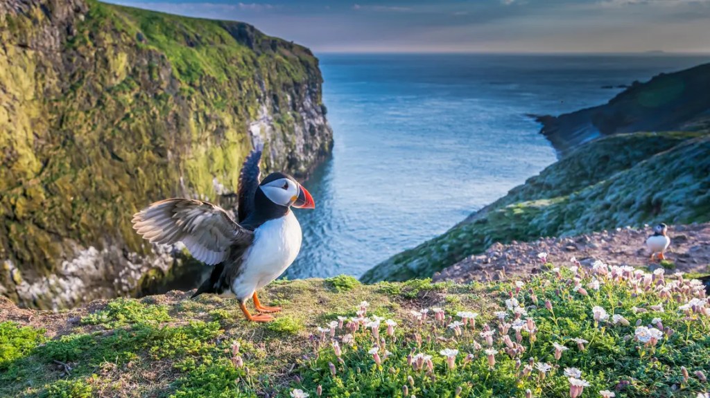
18. Pembrokeshire Coastal Path (2011) – UK
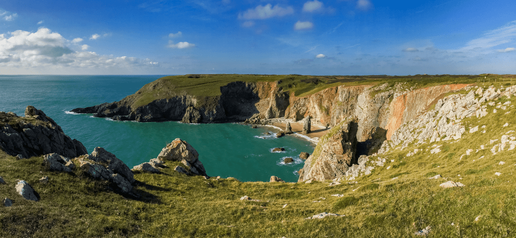
The 186 mile/300km km Pembrokeshire coastal path stretches from St Dogmaels in the north to Amroth in the south taking in the spectacular coast of south west Wales. When I walked stretches of the coastal path with Olivia in 2011 the first thing that struck me was that it didn’t feel very Welsh. On the contrary it felt like a county somewhere in England! We never heard any Welsh being spoken and most of the people we met were English.
Pembrokeshire’s history explains much of its anglicisation. The Normans built massive castles, such as those at Pembroke, Tenby and Manorbier, to assert their authority. Today these castles are reminders that, despite its peripheral geographical position, Pembrokeshire once played a key role in major events.
Henry Tudor (Henry VII) was born in Pembroke Castle and, following his exile in France, landed at Mill Bay near Dale in 1485 on his way to capture the crown at the Battle of Bosworth. In the 17th century, the county was the scene of Civil War conflict with Oliver Cromwell laying siege to Pembroke Castle.
Fishguard can lay claim to be the last place on mainland Britain (* the Channel Islands were occupied by the Germans during WWII) to be invaded by a foreign army In 1797 a ragged French force made an abortive landing near Fishguard, only to be repelled by townspeople and the Castlemartin Yeomanry. 18 years later, the British got their revenge at Waterloo!
It wasn’t the first time I’d come to this part of Wales. An obsession with historical monuments had resulted in my dragging my parents around crumbling crenellations the length and breadth of the UK during my childhood. To their credit, my parents didn’t complain and holidays were often arranged around visits to sites of historic interest. Shortly before going to live in Sweden, my father booked a seaside holiday in Tenby.
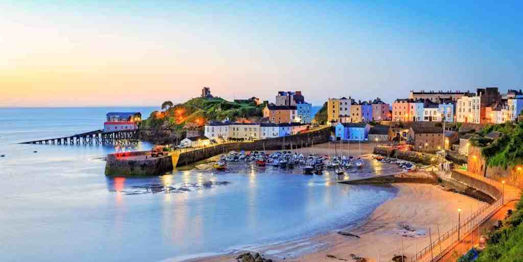
Besides the obligatory castle visits, we spent most of our time on the beach soaking up the sun and, in my case, motoring my way through Agatha Christie novels to which I was addicted. There was a menacing vibe to Tenby where a small riot broke out amongst some drunken teenagers during our first night at the resort. The hotel we were staying in had a rather run down ‘Fawlty Towers’ feel about it and the food was uninspiring – prawn cocktail, over cooked mullet and arctic roll, mainstays of British cuisine during the 1970s!
Fast forward 40 years and Pembrokeshire had undergone a seismic sea change. 3 bedroomed semi detached houses on the seafront in Tenby sell for nearly £1m, you can dine off lobster in upmarket restaurants along the coast and the entire area has become a mecca for second home owners and retirees who prefer its rugged charm over hotspots of the Cornish riviera like Polzeath and Padstow.
In fact the Pembrokeshire coastal path has a lot of things that the South West Coastal path lacks – a cathedral city (St David’s), deserted beaches and puffins, which (unlike some of their relatives in Iceland) don’t end up in a burger!
19. The Pennine Way (2012) – UK
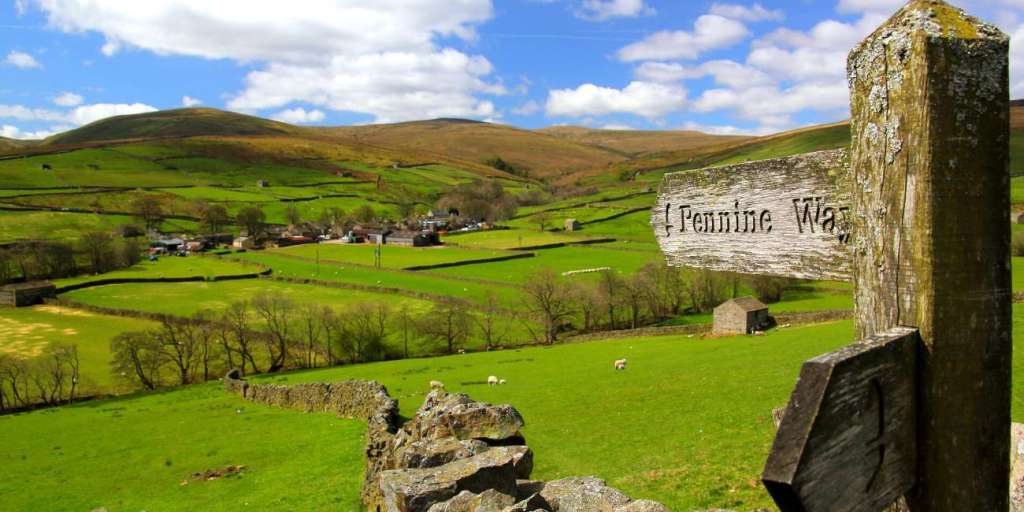
Stretching some 265 miles/430km along the backbone of England and into the Scottish Borders,The Pennine Way is Britain’s oldest and perhaps most iconic National Trail. Every long-distance walker will no doubt at some stage in their lives have this famous route in their sights.
The Pennine Way isn’t the longest National Trail in the UK – that would be the 630-mile South West Coast Path, immortalised in Raynor Winn’s bestseller, The Salt Path. And it isn’t the toughest long-distance hike; that is widely acknowledged to be the Cape Wrath Trail – a 230-mile odyssey through some of the most remote wilderness in the Scottish Highlands. But it is the original designated National Trail and, to the tens of thousands of folk who have walked it, still the best – right up there with the world’s greatest hikes, such as the Appalachian Trail and the Camino de Santiago.
After walking the Pennine Way in 2010, Poet Laureate Simon Armitage summed up the experience with a characteristically pithy coda: “To embark on the walk is to surrender to its lore, and to submit to its logic, and to take up a challenge against the self.”
I walked half of the Pennine Way in the mid 1990s and decided to try and go the whole hog in 2012. The walk didn’t get off to a great start – while changing trains in Manchester and grabbing a Macdonalds cheeseburger before my connection left for Edale, I was accosted by a mean looking teenage thug who demanded that I gave him ten quid for an evening meal. I told him to get lost in no uncertain terms which resulted in us both squaring up in the station concourse before the miscreant sprinted off into the night.
Things didn’t improve when I arrived at Edale (the start point of the Pennine Way) sometime past 10pm. The Youth Hostel was closed and so I spent the night in the local church. I survived, but it’s not something I’d recommend to anybody wanting a good night’s kip.
Thereafter my accommodation improved considerably. A hotel room at Standedge after my first day’s walk, a self catering farmhouse on Saddleworth Moor, a Youth Hostel in Hawes,a couple of nights under canvas at Malham and Bowes and B&Bs at Alston and Horton-in-Ribblesdale. But the strangest place of the lot was the Old Silent Inn at Keighley on the approach to Ponden Mill.
The inn is reputed to be one of the most haunted places in the UK,. Bonnie Prince Charlie is supposed to have stayed there during his invasion of England in 1745. There have apparently also been numerous sightings of a large man with a travelling bag over his shoulder, walking up the stairs of the inn. At the top, he hesitates, looks around and then vanishes. Over breakfast the landlord described a recent ghostly appearance of a man sitting at the bar in a kilt and eighteenth century attire – apparently one of the clansmen who accompanied Bonnie Prince Charlie during the 1745 uprising. Thankfully my stay was undisturbed by poltergeists and things that go bump in the night.
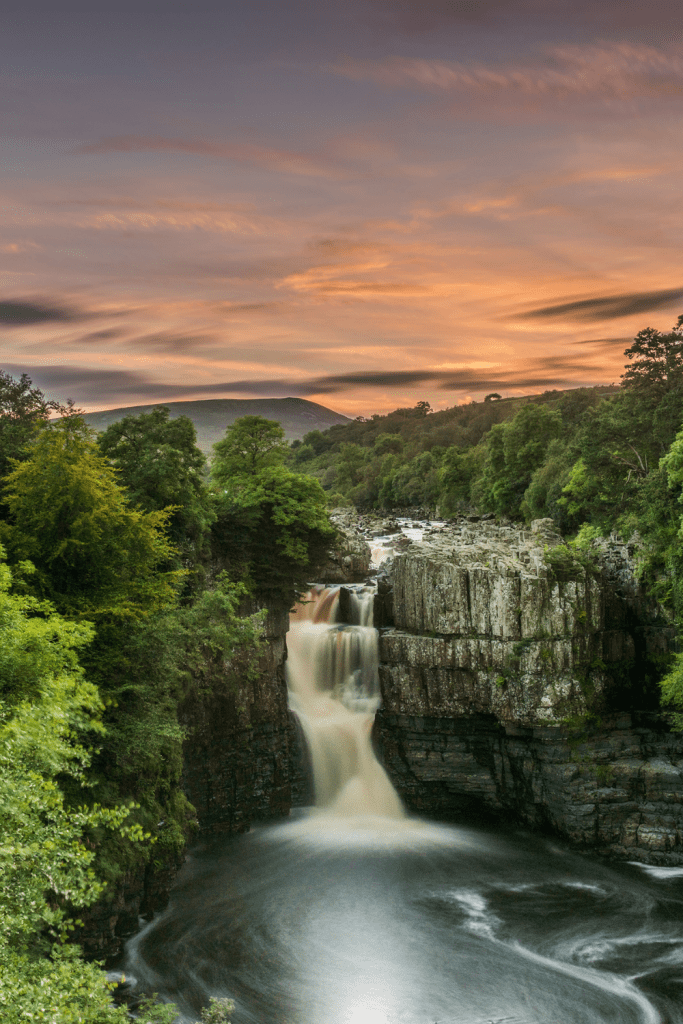
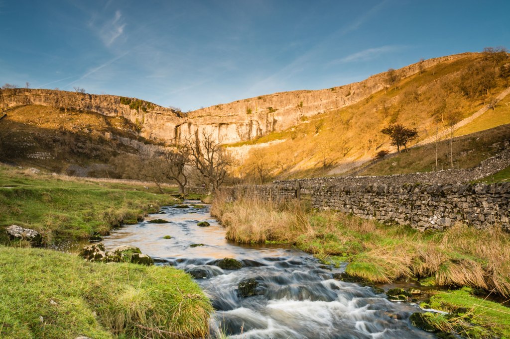
All went well on the walk until I had passed High Force waterfall in Upper Teesdale. After struggling up the vertiginous path to the top of the waterfall I made my way onto the open moor. It was mid afternoon and the weather was closing in. As the clouds descended and the mist thickened, visibility dropped to under twenty feet. The track became increasingly difficult to follow and I didn’t have a clear idea of exactly where I was. All that I did know was that I was somewhere near the edge of High Cup Nick. The geology is fascinating at the head of the glacially created valley is with its Whin Sill cliffs and pinnacles and on a fine day the far reaching panoramic views are breathtaking. I was more focussed on finding a way off the ridge down to Dufton without coming a cropper and breaking my neck! After what seemed an eternity of slow painstaking searching I managed to retrieve the path and make the slow descent to Dufton. Never was i more relieved than when I eventually made it in one piece to the Stag Inn at Dufton!

Although I never quite made it to the end of the Pennine Way at Kirk Yetholm, I had managed to walk 200 miles/320km when I reached Greenhead and hopped on a train to Manchester. The Pennine Way more than lived up to my expectations. Who knows, I might even repeat the experience if I ever get to walk from Land’s End to John O’Groats!
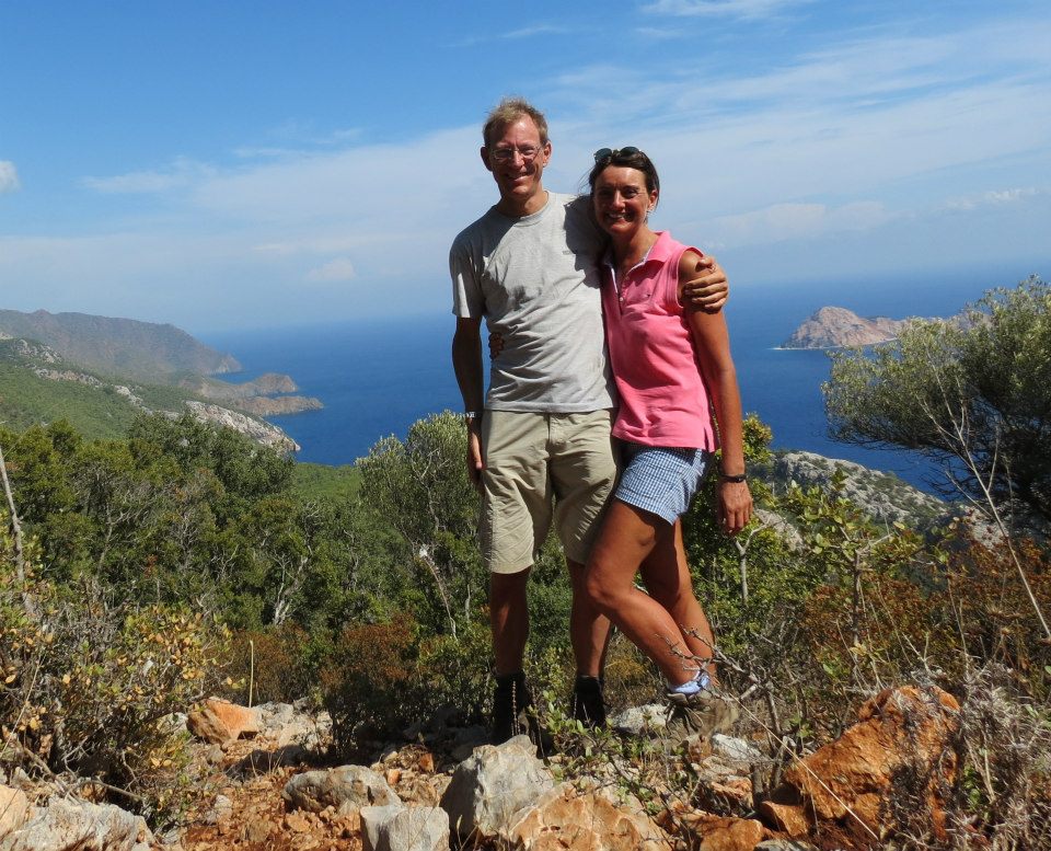
20. The Lycian Way (2013) – Turkey
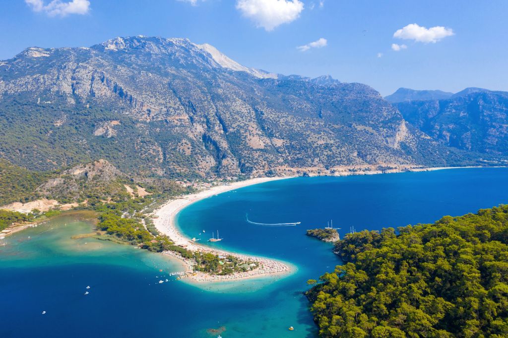
If you like sunshine, sand and skinny dipping then the Lycian Way is for you. Running 475 miles/760km around the south west coast of Turkey it was first opened in 1999. Needless to say, Olivia and I didn’t complete the entire walk.
Our euphemistically entitled 70km “self guided” walk from Gedelme to the lighthouse at Geldoniya was meant to last 6 days and involve walking 3-7 hours a day. The weather in October was ideal for walking, the sea was still warm enough to swim, the walking was gentle, the views were fantastic and we had the luxury of having our luggage transported by car each day and the opportunity to stay in charming guesthouses each night.
These, we told ourselves on the second day of our walk, were the excellent reasons why we had signed up with a Salisbury based tour operator to walk the Lycian Way, as we sat in a Turkish police station near our hotel after some 4 hours of interrogation and form filling.
The tale behind our unwelcome sojourn in a Turkish police station when we should have been skinny dipping in sun dappled coves along the Lycian Coast is one involving an overloaded car, a lost handbag, an obstreperous receptionist at a hotel called the Berke Ranch and a bottle of wine that never arrived and precipitated a phone being thrown at the hotel manager to the alarm of the restaurant full of German tourists! Money was also stolen from Olivia’s handbag and consequently we found ourselves in a Turkish police station the next day trying to explain our misfortune to the authorities. To add insult to injury, at the end of the 4 hour interrogation, we were told that we would have to return to the police station the following morning so that our witness statements could be transcribed into Turkish! Let us just say that the entire experience somewhat took the edge off the holiday!
The walk was great, the food was fantastic and the scenery was spellbinding. Our only regret was having to spend nearly 24 hours in a Turkish police station, an experience you wouldn’t wish on your worst enemy!
21. The Pilgrim’s Way (2021) – UK
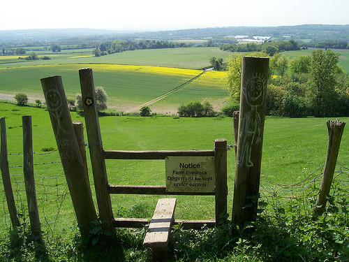
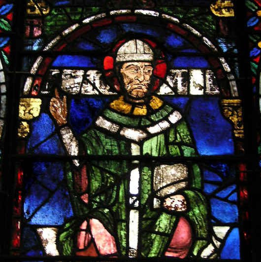
Following the martyrdom of Thomas Becket in 1170, Canterbury became the most popular pilgrimage destination in medieval England. Each year thousands of pilgrims came to visit the shrine of Thomas Becket to pray and seek help for their problems. Many would come long distances, including from all over Europe and as far afield as Hungary, Iceland and India. In fact during the later Middle Ages the route was so popular with pilgrims from London that horses could be hired for set prices at points along the way. This is the road that Chaucer’s pilgrims took in his Canterbury Tales during the late 14th century.
Nowadays, the Pilgrim’s Way, the UK’s premier pilgrim route between Winchester and Canterbury doesn’t enjoy the same popularity as its counterparts on the continent such as the Camino de Santiago or the Via Francigena. Much of that is down to the fact that the Anglican Church all but proscribed pilgrimages after the Henrician split with Rome in the 16th century. As a result, pilgrims on the 155 mile/250km path to Thomas Becket’s tomb at Canterbury Cathedral are few and far between. In fact I don’t remember meeting a single other pilgrim on my entire walk from Winchester to Canterbury in August 2021!
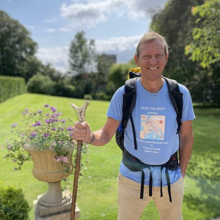
As part of my efforts to raise funds to repair the roof of St Peter’s church in Winterbourne Stoke by walking to Rome, my route took me along the Pilgrim’s Way. Despite for many years living near the path on the north Surrey Hills, I had never taken the opportunity to walk the Pilgrim’s Way in its entirety. I wasn’t to be disappointed.
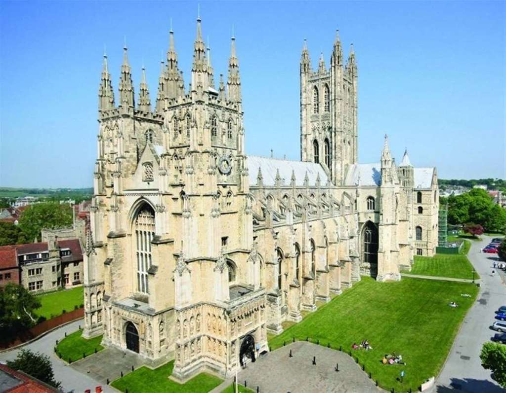
Having paid my respects to my alma mater (Winchester College) and attended evensong in the magnificent medieval Cathedral, I set off for Canterbury following the course of the Itchen and Test chalk stream rivers.
Without the company of fellow pilgrims it could have been a lonely walk. The UK was just emerging from the Covid epidemic and still unaccustomed to venturing out of its Covid “bubble”. I was blessed with good weather and the hospitality of a number of Church of England churchwardens and rectors who had kindly agreed to accommodate me on my walk. Their reflections on the challenges of running a rural parish and slowing the terminal decline in attendance numbers at their weekly Sunday services was a sobering insight into the myriad of challenges facing the modern day Church of England.
Congregation numbers had been whittled down by the toll Covid had taken on some of the faithful as well as the Church of England’s insistence on closing churches and stopping services during the height of the epidemic. The decision of the church hierarchy to focus fund raising efforts on climate change preparation, slavery reparations and safeguarding courses for all church members coming into contact with children rather than focussing on vital repairs to crumbling church fabric and leaking roofs looked liked becoming the final nail in the proverbial coffin.
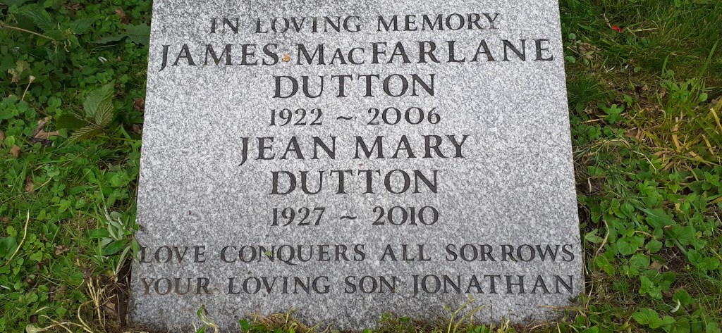
The walk was partly a personal pilgrimage, an opportunity to revisit the area of Surrey between Guildford and Dorking where I had spent much of my childhood and an opportunity to visit the spot in the churchyard at Headley where my parents were commemorated. Bittersweet memories of Boxing Day visits with my parents to the Cock Inn at Headley and the commemoration service I had organised for my parents in April 2011 over a decade previously. How time had flown over those ten years.

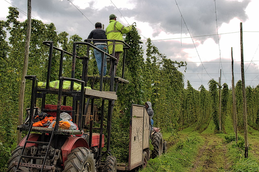
As I crossed the border from Surrey into Kent, it was sobering to see how much the countryside had changed over the previous 25 years. Known as “The Garden of England” much of Kent had been covered in hop fields until cheaper imports from Eastern Europe and the proliferation of lager had led to a drastic decline in prices for English hops. I remember spending many summer vacations from university picking hops on a farm near Goudhurst. The harvest lasted the entire month of September and on many farm, including the one I worked on, East End families would still come down for the hop picking harvest.

At its height, from the 1920s to the 1950s, around 200,000 Londoners would make the trip to hop gardens at Paddock Wood, Maidstone and Faversham on the ‘hopper’s specials’ trains laid on for them.The hoppers were paid by the bushel (eight gallons in volume), meaning that an average family working for four weeks in the 1930s and 1940s could earn £40 – the equivalent of ten weeks’ pay.
Even during the Second World War, when bombs were raining down on Kent, many women preferred to take their chances in the county’s hop gardens rather than go back to London and face the Blitz. But the blissful pilgrimage began to decline in the 1950s – thanks first to British brewers’ decision to import American hops; along with a virulent viral disease which hit the Kent hop crop. Then, when hop-picking machines arrived – again from the US – farms needed far less workers. It meant that by the beginning of the 1970s, the annual exodus of cockneys to Kent had largely died out.
Today the hop fields of Kent have completely vanished with the last ones disappearing 15 years ago. They have been replaced in part by vineyards as climate change has made growing grapes in the south of England a more lucrative proposition than hops. Call me old fashioned but vineyards don’t quite have the same feel about them as the old hop fields of Kent once did.
I completed the Pilgrim’s Way in a little over a week. Ironically reaching Canterbury didn’t feel like the end of the journey, more like the beginning of another journey – walking 2,300km to Rome along the Via Francigena. The Pilgrim’s Way seemed like a warm up before the main course, but nevertheless I was glad that I had finally managed to complete the walk from Winchester to Canterbury!
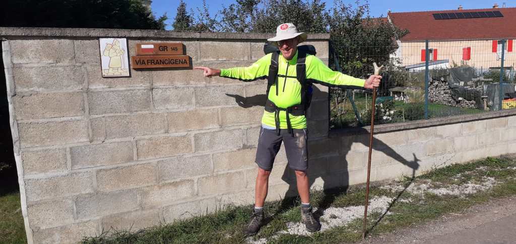
22. Via Francigena (2021) – France/Switzerland
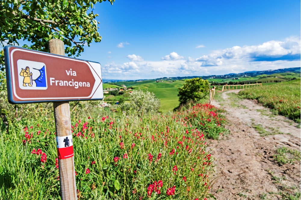
If it hadn’t been for the Covid epidemic (and to a lesser degree Brexit) I almost certainly wouldn’t now be living in the South West of France writing long blogs about walking! When I try to put my finger on exactly what prompted me to set out from Winterbourne Stoke on the 22nd August 2021 to walk 2,300km to Rome along the Via Francigena, then the Covid epidemic was probably the major reason. In one fell swoop the epidemic torpedoed our language school business and left us, like everybody else in the UK, incarcerated in our homes for most of the next 18 months. By August 2021 I was stir crazy and up for a challenge. Walking to Rome seemed like a good idea and a way of raising the money needed to fix the village’s church roof!

Despite being an avid long distance walker and an Oxford history graduate, I’m ashamed to confess that until the autumn of 2020 I’d never heard of the Via Francigena, a medieval pilgrim route from Canterbury to Rome, which follows the itinerary of Sigeric, an obscure 10th century Archbishop of Canterbury who undertook the hazardous return journey in 990AD to collect his pallium from the pope. A far less popular pilgrim route than the Camino in France and Spain, the thought of walking from Canterbury to Rome was something that stirred my soul and set my pulses racing. The big question was, where could I get more information about this obscure route across Europe?
Had it not been for the Covid epidemic I would probably never have come across the inimitable Harry Bucknall and discovered the Via Francigena. Thanks to social media I was able to read his account of the walk (Like a Tramp, Like a Pilgrim”), contact him, pick his brains about the walk and invite him down to give a fund raising talk at St Peter’s church just before I set off on my pilgrimage to Rome.

It is difficult to condense my experiences of walking the Via Francigena into a few paragraphs of purple prose. Although I only met four other pilgrims on my entire two month walk, I never felt lonely. That was largely down to the amazingly kind and generous host families who accommodated me on the walk. It is impossible to cite them all, but some of the most memorable evenings included an inebriated meal in a Mongolian yurt in the back garden of the churchwarden and his wife in Shepherdswell; an evening dining out in the garden of a charming Madame Tordeux-Bremard, octogenarian aristocrat who lived in the lea of Leon Cathedral and whose house was adorned with the stuffed masks of numerous fearsome looking wild boars which she had shot over the years; a stay in a medieval watermill; an evening in a gypsy caravan with a 75 year old French pilgrim called Georges whom I spent the best part of a week walking with; and last but not least, staying in a family farm near Besancon and enjoying a five course supper fit for a king in the company of the proprietor and her centenarian mother!

As well as staying with pilgrim host families, I stayed in monasteries and abbeys, camped out on a few occasions and even spent a night in the company of an American pilgrim in what can only be described as a public loo! From the sublime to the ridiculous!
Conversations over supper with my hosts were many and varied, but there was one topic which always seemed to rear its ugly head – Brexit. The length and breadth of France and Switzerland there was general consternation mixed with genuine sorrow that the UK had decided to sever its links with the continent and leave the EU. “Did you all take leave of your collective senses?” was the question on everybody’s lips. My only rather limp response was simple – Brexit was meant to enable the UK to ‘take back control’ and save the NHS. But such explanations never seemed to cut the mustard with my hosts. In the end all I could say was “Blame Boris”.

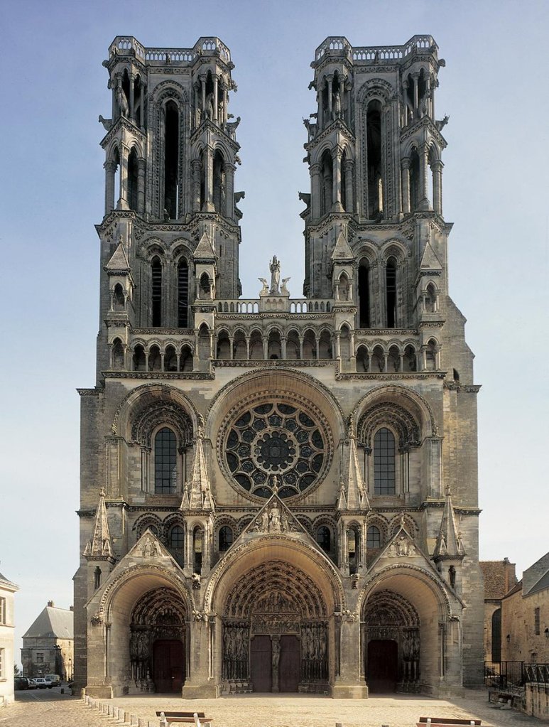
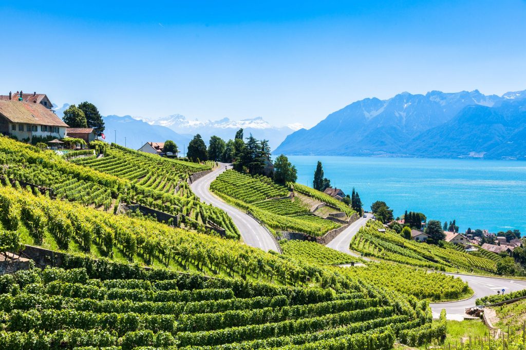
Highlights of the walk are too numerous to mention but they included the cathedral cities of Arras, Rheims, and Laon, the picturesque city of Chalons-sur-Champagne; the weekends visiting the WW1 battlefields in northern France and tracking down the spot where my great uncle lost his life in the Somme offensive during WWI as well as spending time in Beaune and Dijon with my Belgian friend Claude; walking along the Opal coast near Calais, crossing the Jura mountains and walking along the banks of Lake Geneva from Lausanne to Vevey.

I still savour the time spent walking with a French pilgrim called Georges and shudder at the thought of the day when I took a wrong turning in a forest en route to Bar-sur-Aube and ended up walking 55km in the day!
I was blessed with fine weather and benefitted from the kindness of strangers from the English channel to the Alps – Mike and Stella, the lovely couple from Shepherdswell who helped procure a bicycle for me so I could board the cross channel ferry in Dover, Luigi and Riccardo the Italian brothers who ran a chain of Italian restaurants in London and generously treated me to breakfast on the cross channel ferry to Calais, Sebastian who gave me a free breakfast from his van during the wine harvest near Trepail, and Timothe , the penniless pauper who shared his pasta with me in the monastery of Saint Maurice.
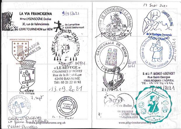
At the end of October, after two months walking nearly 1,000 miles (1550km), a passport full of pilgrim stamps and more than enough money raised to repair the church roof of St Peter’s, I flew home from Geneva. I was fitter, wiser, and happier than when I had set out. I’d walked further than ever before in my life and did so without getting a single blister! I had also made an interesting discovery – France and the French were marvellous and I wouldn’t mind living there at some point in my life….. And as for the Via Francigena – it was so much fun I’m almost tempted to walk it again!
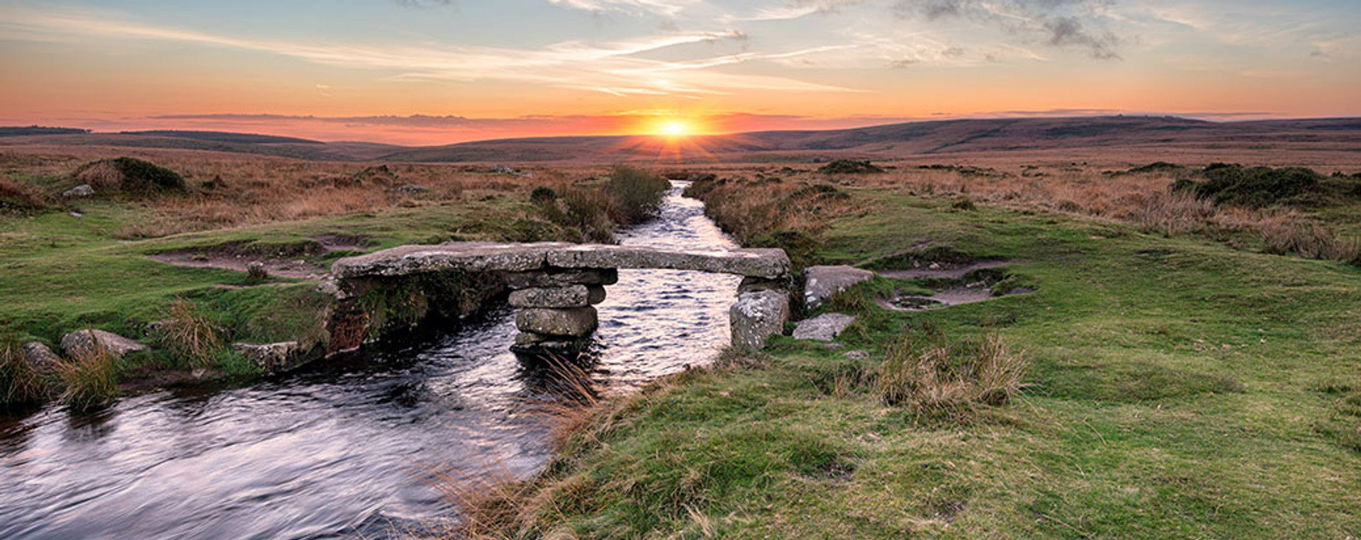
23. The Two Moors Way (2022) – UK
“Walking”, my closest school and university friend and neighbour in Devon when I lived there briefly some 20 years ago,” should only be done with a dog. Otherwise it is pointless.”
It is fair to say that Edwin wasn’t the most adventurous person I have ever known. Taking his two springer spaniels for a spin around the field at the back of his cottage, sometimes seemed like an e chore of Herculean proportions for him. Despite having lived on the edge of Dartmoor for over 50 years, as far as I know he had never walked further than the top of Haytor less than 500 metres from the pub in the village! The thought of walking 117 miles/187km across Dartmoor and Exmoor from Devon’s south to north coasts, would have bewildered him. He had claimed to be vindicated when I had had to abandon an attempt to walk the Two Moors Way in the late 1990s after encountering torrential rain on Dartmoor and getting soaked to the bone. 20 years later, a few weeks before embarking for a new life in the south west of France, I decided to give the walk another go!
Having spent the night with Geoff, a friend from SG Warburg in Hong Kong who now runs the family dairy farm in the South Hams of Devon, I set off from Holbeton towards Ivybridge. Geoff accompanied me for the first couple of hours before having to return to his farm at Carswell – somebody was dropping round later that morning to buy his electric Porsche!
Later that day, heading out onto Dartmoor somewhere near Hangman’s Tor, I bumped into a couple of German walkers who were hopelessly lost! They were a father and son on holiday from Cologne and although they hadn’t got much of a clue about where they were,they didn’t seem particularly bothered. ‘Ve vill find somewhere to camp on the moor. Maybe tomorrow ve vill find some shops to buy some food”. They thought they were on The Two Moors Way heading towards Scorriton but I had my doubts. After a mile or so, I decided to part company with them, do a U turn and head back where I’d come from. It proved a wise decision because it became rapidly apparent that they had been heading in completely the wrong direction for Scorriton
The next day I had a bizarre encounter on Hamel Down Tor just beyond Widdecombe-in-the-Moor. It was a section of the moor I had walked many times when I lived nearby in the Teign Valley. As I walked along the ridge towards the remains of the Bronze-age village at Grimspound, In the distance I could see four people walking in a group along the ridge towards me. One appeared to be wearing a tweed cap but it was the larger man on the left of the group that caught my attention. There was something oddly familiar about his gait….
As I approached the group I could hardly believe my eyes – it was Gerald and Emma, two university friends from Wiltshire with a couple of their friends out for a walk on Dartmoor. They were also astounded at meeting me in such an unlikely setting. It seemed like a strange kind of synchronicity had drawn us together! What was equally bizarre, was the fact that they lived just 20 miles away from us in Wiltshire and over nearly a decade our paths had crossed just a handful of times!
Apart from the beauty of the landscape, one of the things I love and miss most about the UK is the history of the places you pass through. The smallest hamlet often has the most fascinating story to tell. Nowhere was this more true than the little hamlet of Hittisleigh whose most famous son was a pirate called Samuel Bellamy. Born in the village in 1689 he died 28 years later as the wealthiest pirate in recorded history, amassing a fortune exceeding £100 mn! His parents were likely tenant farmers, hovering on the edge of starvation like half of England at the time
Bellamy left home at a young age for Plymouth, becoming a ship’s boy at 13 in 1702 at the outset of the War of Spanish Succession. By the end of the war in 1712 he was a skilled sailor. After travelling around Cape Cod in 1715, he then went south to the Florida coast in search of sunken treasure. Although his known career as a pirate captain lasted little more than a year, he and his crew captured at least 53 ships. The ship he sank with in 1717 (a slave ship bound for Jamaica that he had captured from the English) , called the Whydah Gally, reportedly held more than four and a half tonnes of gold and silver when she went down with all hands in a storm! It was a short, spectacular life and unlikely life which took “Black Sam Bellamy” from the mist shrouded moors of Devon to the Caribbean and the wealthiest pirate in history!
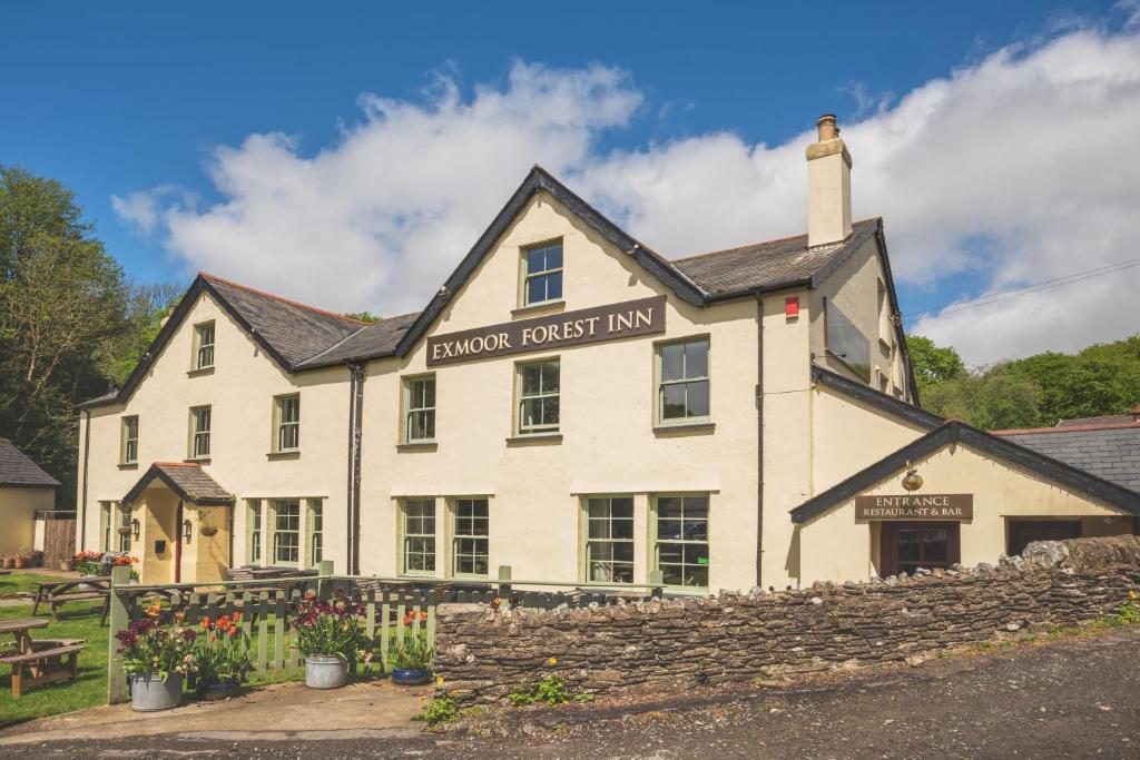
My final night before returning home to Winterbourne Stoke, was spent in a tent outside the Exmoor Forest Inn at Simonsbath. I’d half hoped that I might have another unexpected encounter in the pub that evening – with Boris Johnson, the ex PM whose family house was just up the valley. I was hoping I could give him both barrels about Brexit and vent my spleen about the state of British politics. But sadly there was no sign of Boris that evening and I had to content myself with a final pint of beer and steak and kidney pudding before heading off in a couple of weeks for a new life in France. Who knows what Edwin would have made of it all!
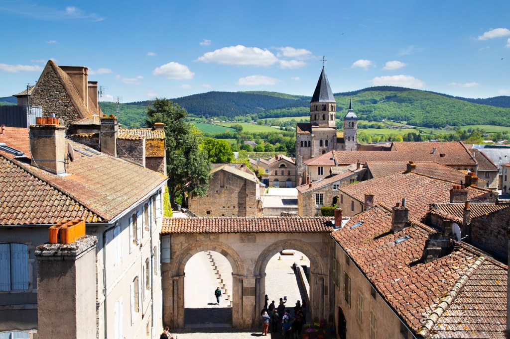
24. Chemin de Cluny (2024) – France
The Chemin de Cluny is a pilgrim route that runs 195 miles/310km between Cluny and Le Puy-en-Velay. Although its technically one of the pilgrim routes to Santiago de Compostela, most pilgrims tend to start from Le Puy. Hardly anybody seems to walk the route – over the 8 days that I was on the path I only met 5 other pilgrims and 4 of those weren’t actually walking the Chemin de Cluny! But perhaps that isn’t altogether surprising as the pilgrim route wasn’t formally established until five years ago.
What the Chemin de Cluny does have is a network of host families, known as jacquaires, who for a discretionary sum (20 -30 euros) provide pilgrims with an evening meal, a bed for the night and breakfast. Just as on the Via Francigena, the pilgrim hosts that I met were amongst the highlights of the walk.
Cluny is somewhere I’ve always wanted to visit, so walking from there to Le Puy-en-Velay seemed to make sense. From Le Puy I planned to continue across the Aubrac to Nasbinals and then join the Chemin Urbai V which would take me to Avignon, another place I’ve always yearned to see. It seemed like a good plan. Fate, however, was set to intervene and inexorably alter my plans.
For those reading this blog who aren’t historians or medievalists, its worth saying a few words about Cluny. Founded in the 10th century, the order of Cluny restored the rule of Saint Benedict, benefited from the protection of the papacy and extended its influence across Europe to the point that nearly a thousand establishments were attributed to it at the end of the 13th century. Sadly most of the medieval abbey,which was once the largest church in Europe, was destroyed during the French Revolution, but for all that Cluny remains a charming and vibrant town and a great place to commence a walk from.
I completed the 310km walk to Le Puy in 8 days, averaging 39km a day which involved walking for up to 11 hours a day! Thankfully I didn’t need to use my tent and was fortunate to enjoy some wonderful hospitality en route. Those that spring to mind include, Nicholas, the genial host of the Gite Oreiller de Pelerin at St Jacques-des-Arrets; Gilbert, a retired Army colonel who entertained me in his sumptuous farmhouse near the Col -de-Buche pass;Claire, who put me up in her 20 bedroom house near Champdieu and Jacques who has been hosting pilgrims for nearly a decade in the picturesque mountain village of Marols – I was only the second British pilgrim he had encountered!
Spending time walking in the company of other pilgrims is one of the particular pleasures of a walk like the Chemin de Cluny. On my third day’s walk I crossed the path of Renaud, a French pilgrim and we shared a couple of hours chatting away together. Renaud worked in Lyon as an administrator in local government helping small local businesses get established in the Haute Loire and Rhone and Saone districts, a fairly huge area of France. He’d grown up in Iran before the Shah was overthrown and had spent time in Venezuela! You meet all sorts of interesting people on long distance walks whom you would never stand a chance of bumping into if you remained cloistered in your local community.
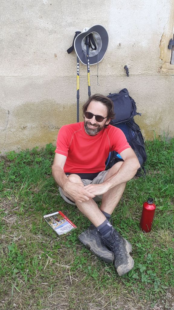
25. Via Gebennensis (2024) – France
It was a toss up whether to include the Via Gebennensis or the Chemin de Regordane in my top 25 walks. I walked both in September this year. The highlight of the Chemin de Regordane was visiting Nimes with its wonderful Roman amphitheatre. However, the Via Gebennensis gets the nod because not only is it longer than the Chemin de Regordane (352km v 248km), the scenery is more varied, the end of the walk in Le Puy is more uplifting than St Gilles du Gard and the Via Gebennensis benefits from having a network of pilgrim host families (accueils jacquaires) who offer pilgrim accommodation.
According to four members of the Rhone-Alpes Jacquaires that I met at Netdens on my first afternoon, the Via Gebennensis is growing in popularity. Each year around 2,000 pilgrims set off from Geneva to do the walk. That is a drop in the ocean compared to the 70,000 pilgrims who set off from Le Puy-en-Velay towards Compostella but it is impressive nonetheless.
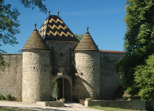
As pilgrim accommodation goes, it doesn’t get much better than staying at the Chateau de Pelly, some 53km south of Geneva. It is run as a gite but there is a room specifically allocated for pilgrims walking the Via Gebennensis. Sadly I never got to use the swimming but, hey, you can’t have everything in life!
Apart from the final stop at Le Puy-en-Velay, the Via Gebennensis doesn’t pass through any towns or villages that you’d necessarily go and visit if you weren’t on the walk. Perhaps the most attractive spot was Chanaz, known as the little Venice of Savoy. Nested beside the canal next to the Rhone, Chanaz is the perfect place for a lazy lunch and taking the time to watch the world go by.
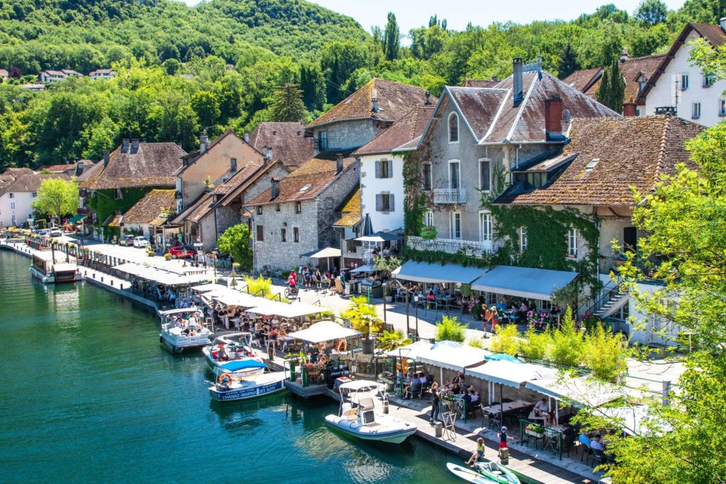
If I was walking the Via Gebennensis again, one place I would definitely stay would be the ‘Gite of a thousand colours’ midway between Ornaciouex- Balbins and Saint Romieu-de-Surieu. Run by a charming charismatic Frenchman called Fred, for whom hosting pilgrims is a passion (he gets up at 3am every morning to work in a local bakery to make ends meet!) I can’t think of a more congenial spot to spend a night! Sadly I only had the opportunity to spend an hour in Fred’s company but that was ample time to hear some of his fascinating pilgrim encounters!
Perhaps the oddest encounter I had on the walk was in a little village called Saint Julien-Molin-Morette where I stayed in the basement studio of Yannick, an octogenarian artist, local journalist and confirmed eccentric. She shared stories of her Bohemian upbringing with myself and a fellow pilgrim over a doner kebab in a Turkish takeaway restaurant just round the corner from her apartment.
I completed the 352km walk in 11 days, averaging 33km a day. Blessed with good weather, wonderful pilgrim host families and a stream of interesting encounters, the Via Gebennensis definitely gets my seal of approval!
So there you have it! I’ve come a long way since taking those first steps on Horton Plains in Ceylon some 55 years ago. Over that time there were places I wish I’d travelled to but never did such as the Amazon rainforest, Lake Kailash in Tibet and Machu Picchu on the Inca Trail in Peru. But Taimen fishing in Mongolia, travelling across India and China on the Silk Road and visiting North Korea a couple of times are more than ample compensation for the places I haven’t got to..


And as for what the future holds in terms of walking, well who knows. In life, you never really know what is around the next corner. One thing is for sure though – its going to take me a good few years to complete the remaining 30 long distance walks that are still on my “Bucket list”!


Leave a comment